We’re teaching American History this year, and since I’ve been sprucing up our home school room a bit, I was looking for some functional art to use on the bookshelves. To a. add more color in the space, and b. hide things behind it, because school isn’t always pretty.
I’ve decided we all need to brush up on our geography skills {see: mom} and I really wanted a quick reference map of the continents when discussing things like history or science or even literature to give the kids a quick reference and world view.
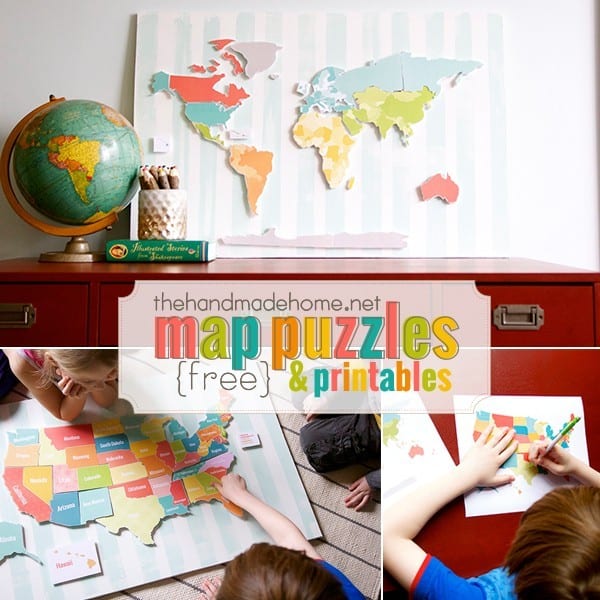
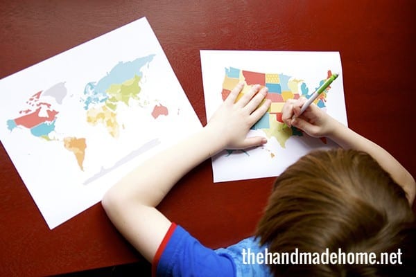
After milling around for a bit, I decided to make two maps. One of the continents, and another of the United States.
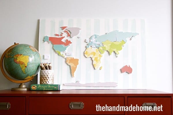
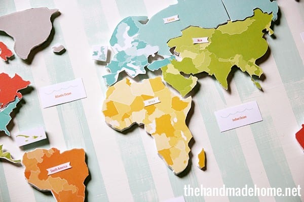
 The first map is a bit of a basic overview for the continents
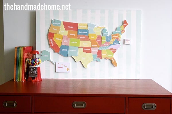
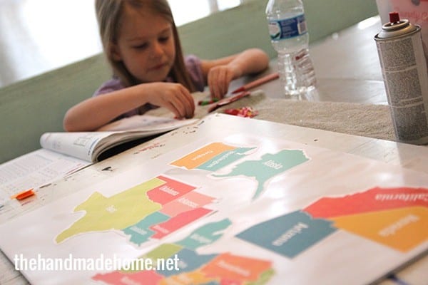
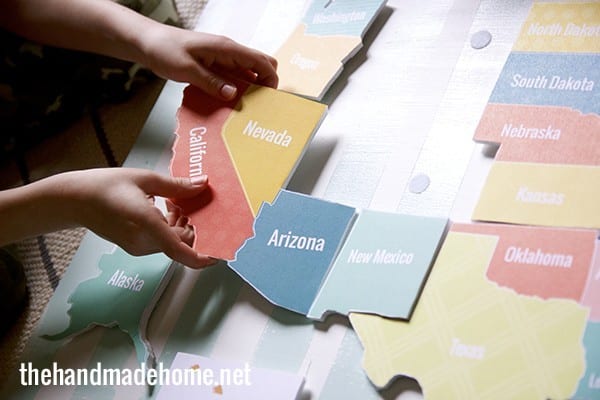
And then, because our room needed symmetry on those shelves {and this was just pretty}… I went with the US, as well.
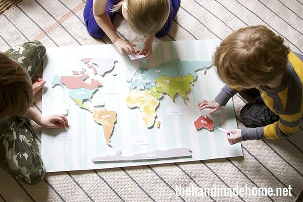
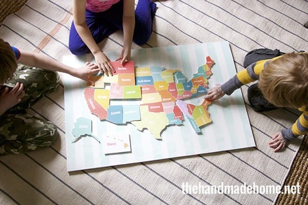
The kids absolutely love them, and I love that when they’re not being used for learning, we can have them on display in the space for pretty, colorful, inspiring fun.
Here’s how I did it…
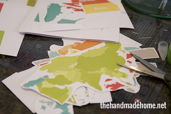
After I designed them I printed out each little section.
{Necessary disclaimer: It was, uh, detailed y’all – please note that it’s more of a stylized map for quick reference, and I tried to keep a lot of the lines straight for easier cutting. Some nations like Canada have a lot going on with all their islands, so I designed it in a way that kids get the general idea without giving myself and anyone else who wishes to print and cut permanent stiff neck and fingers- we love you Canada and I promise my kids will know what you really look like. We’ve also received some messages from Australia from leaving off their island. Again, basic… and we do care about you, Australia. We actually use a globe for full on continent lessons, so please keep that in mind}
When each one was finito, I made sure I had a complete map of each, and gave the little continents and states a generous border. {Printed on card stock}
I purchased some foam board at the local craft store for a few dollars, and using some general spray adhesive, went outside to spray it down.
Then I placed pieces that would fit on the foam board once it was tacky, {as in sticky not bad taste} pressing down on all the edges to make them smooth. It didn’t take long to cut each board out – using an Xacto blade. (Probably a couple of hours for each map-you can tackle them in sections if it seems like a doozie.)
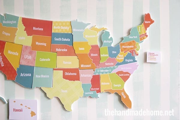
I know this isn’t for everyone but I knocked out the US one yesterday morning while we did school with the kids at the kitchen table. {Make sure you have a surface beneath you that can stand cuts – like a self healing mat.} Tip: This map has little dotted lines in an off-set “style” kinda look. So, be sure to follow the actual color-border of the state/continent and you will be fine with your cutting.
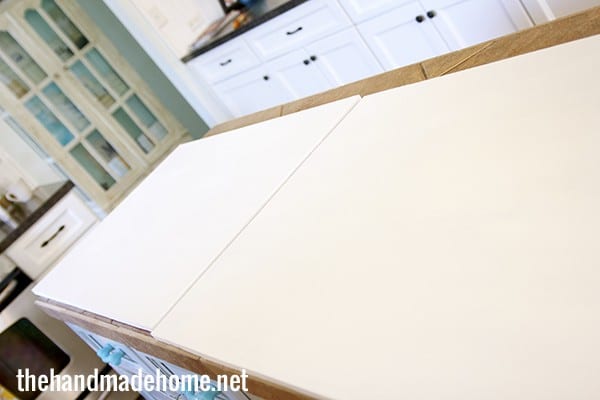
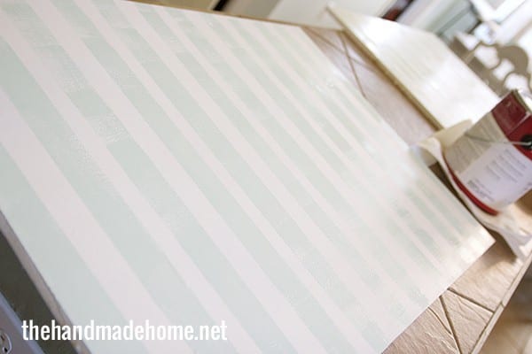
In the meantime, I took some thin MDF { 33 x 22 } gave it a coat of white, and when that was dry, went back with tape of varying widths and added stripes of blue with a bit of a dry brush, wiping some away as I went. {This is one of my faves – Benjamin Moore’s At Sea} This will be the base of your map, if you wish to have it as functional decor, and a good surface for the kiddos to work on.
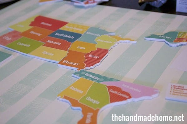
When I was finished cutting each piece out, I fit them together.
If you just want plain paper, that works too, but the foam makes it easier for the kids to grip the map pieces, and if pieces aren’t fitting together perfectly (I’m not a flawless cutter by any stretch of the imagination) I found that the foam formed together better when pushed and trimmed underneath. {Cheater alert}
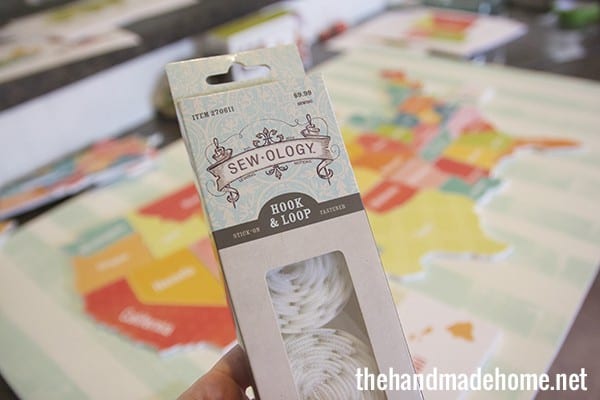
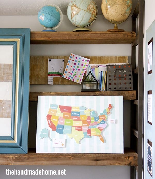
When the board was dry, each piece went in place, and I used a little stick-on velcro to place each piece where it would go.
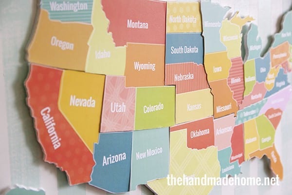
Tada! We have a map!
This little continent map comes with labels so your kids can put the pieces where they go, along with the continent names + oceans.
Want the maps? Click for the Continents here {1, 2, 3, 4, 5, 6} each one prints out on an 8 x 10 + you can piece the larger ones together to form all the pieces.
And the American map here. {1, 2, 3, 4, 5, 6, 7, 8}

You could even do this with just paper and scissors if that makes things a little easier. And leave the white on the big parts.
Your older kids could use the printables with safety scissors. You could even laminate one flat and draw on it with a dry erase marker. And you can mark the places you’ve been with washi tape! Do I need to keep going? Endless fun, for nerds like me.
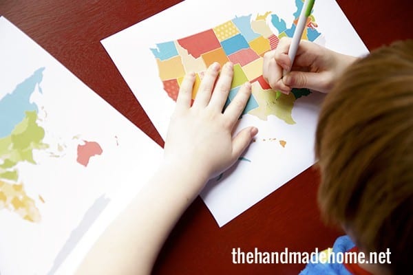
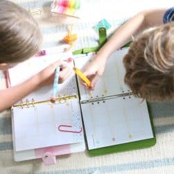
Puzzles aren’t your thing? We have little printable versions here, both labeled (continents, USA) and blank (continents, USA), so your littles can brush up on their geography skills in style. They’re super cute little pages for any of you learning their geography!
Hurray for creative learning!

Thinking of any of you who are starting back soon… and in the meantime, enjoy with lots of creative fun!
Let us know if you use them, and enjoy! Have an inspired day!
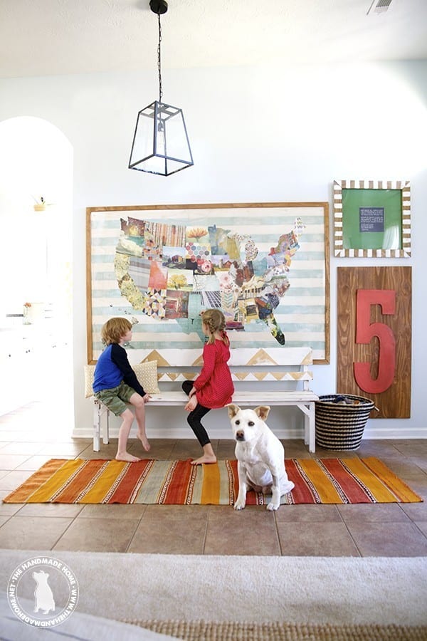
Pssst: check out the how to for our extra large map of the USA, here.


These are beautiful! You are so generous to share all your hard work!
Whoa whoa whoa, let’s just slow down with the awesome here, lady! These are AMAZING! Thanks for doing all the hard work for us. I can’t even imagine how fiddly it would have been to put together. I luuuurve them 😉
So awesome! I love these and I just pinned them – they’re going to be some awesome summer learning activities for my chickies!
Girl I have always liked your blog, but recently your content has been the bomb dot com. These are so cute, my kiddos are younger, so I may just do the US, and that may be a stretch, but I just want it in my life. Thanks for sharing!
there are amazing. you should sell it 🙂 but way I need to download first 🙂
Wow! This is great! Thanks for sharing, I love it. I am going to try and make for my kids. Amazing!
I’m in love with these! You are amazing! Thanks for sharing your brilliant printables-I love them all!
Thank you so much, Melanie! ;}
We are a homeschool family too! We are part of Classical Conversations and learned the continents and oceans at the beginning of the year. Your kids would love this song we learned them too…if you don’t already have it. 😉
Here is where you can find it.
http://www.amazon.com/Continents-and-Oceans-Song/dp/B002CAZPLA/ref=sr_1_3?ie=UTF8&qid=1394646593&sr=8-3&keywords=continents+geography+song
Thanks for sharing your hard work!
Lindsey
Your printables are amazing and you are so generous to share them! I recently printed, framed and hung your positive printables in my youngest daughter’s room and bath. They look great, and they make me smile. 🙂 Now I want this one too! Thanks so much!
These maps are fabulous!! My grandchildren will absolutely love them. Thank you so much for sharing.
Wow these are amazing!! You are amazing! I’m so excited to make these!! Thank you! Thank you!
this is a great post! I will be making one for my grandson. Will have to enlist his mom and dad to do the board as they live 1000 away. He’s 3 1/2 and will love it. Thanks so much for all your hard work designing it and sharing. So sweet!
barb
this is so great! thanks so much for sharing!
Will you be my mom too?! You always have the happiest projects with adorable end results. I love that you make learning so fun!
You’re too sweet, Jen! ;} Such a compliment coming from the queen of fun herself! ;}
Wha???? I am gobsmacked you made these. They are truly stunning! I so wish I had somewhere (anywhere!) to put them but I just don’t. Plus I would actually have to make them myself and that ain’t happenin’ right now…. 🙂 Amazing!
Wha???? I am gobsmacked you made these. They are truly stunning! I so wish I had somewhere (anywhere!) to put them but I just don’t. Plus I would actually have to make them myself and that ain’t happenin’ right now…. 🙂 Amazing!
They’re beautiful! Thanks!
I can’t wait to print these out and use them, what a generous share!
Love it!! Thank you for sharing 🙂
Thank you for sharing these, printed them out and have all the supplies to make tonight. Also need to send you an updated picture of our finished fort, it looks so different. THANK you so much for sharing these and making them, we are toying with homeschooling our soon to be 5 yr old, so I am going to do a bit of a trial run this summer 🙂
These maps are totally awesome! I’ve been looking for maps with ‘style’ for such a long time! Thank you so much for sharing!
Love these and will be printing them out for my children 🙂 One HUGE issue I have though is as an Australian I would like to know where is Tasmania and why has it been left off?
Hi Naomi! If you will please note that this was a handmade map, which basically means there where a lot of simplifications in the process, to make it doable. Note that most of Canada probably hates us. ;} Also, it’s free, so there’s’ that. ;}
Thank you for the reply 🙂 I’ll add Tassie just for our use as we are actually in Australia. Please don’t think I don’t hugely appreciate your wonderful effort and the fact that it is free 😀 Thanks again!
LOVE these!! I have spent the last hour downloading so many of your brilliant and creative printables. Thank you so much for sharing your amazing creations.
Thanks so much, Tristine! ;}
Oh my word!! Speechless! picking my jaw up. off. the. floor…
Thank you!
thanks for stopping by- so glad you can use it! ;}
Amazing! Wish that I had teachers that were as creative as you to teach me geography. I love how you always have lots of colour in your projects. And believe me I understand the importance of making sure to have a self healing mat. Canada looks great. Thanks for saying you love us!
LOVE love LOVE love LOVE!
Love this post and all of the great printable maps. We studied the US last year and cooked a meal from every state. I blogged about if you want to read more on my website (Odyssey Through Nebraska).
Graet project! Definitly sell it.